


Environmental Studies
Inventory of the Terrestrial Environment
The terrestrial environment of Gyaros island, and particularly the Natura 2000 area, hosts dozens of rare animals and plants. To formulate and then propose the appropriate nature conservation and protection measures, there must be a clear and coherent picture regarding its flora and fauna and the natural habitats that are found on the island, the resident animals and birds, the types of plants that grow on its steep slopes.
In order to acquire the necessary knowledge on status of the terrestrial fauna and flora and of the natural habitats found on the Gyaros Natura 2000 site, a series of activities will be conducted:
• The “CYCLADES LIFE” project team, assisted by expert scientists in various fields, will start by conducting an extensive literature research, in order to gather all existing scientific information related to the natural environment of the island.
• A series of scientific field surveys will be conducted on the island of Gyaros to collect the necessary data, so as to assess the current status of the natural terrestrial environment of the project area, end especially of the Natura 2000 site. Consequently, extensive data will be compiled on the island’s biodiversity (both flora and fauna), and on the status of the terrestrial habitats of Gyaros island.
• Particular emphasis will be given to the reptile and bird fauna, and to the flora and the vegetation of the island. A team of expert scientists in various fields will collect data on site concerning the variety of species, the population of reptiles, the presence and abundance of seabirds and raptors, as well as other types of birds. The documentation of the data collected from the field on the flora and vegetation of Gyaros will be based on direct observation of its various plants, on the collection of unrecognized species and on the quantification of abundance, density and coverage of vegetation.
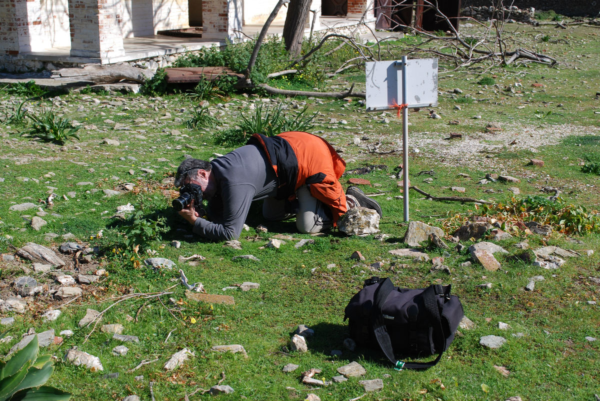
© C.Papadas/WWF Greece
• Particular emphasis will be given to the reptile and bird fauna, and to the flora and the vegetation of the island. A team of expert scientists in various fields will collect data on site concerning the variety of species, the population of reptiles, the presence and abundance of seabirds and raptors, as well as other types of birds. The documentation of the data collected from the field on the flora and vegetation of Gyaros will be based on direct observation of its various plants, on the collection of unrecognized species and on the quantification of abundance, density and coverage of vegetation.
This important action will result in a baseline inventory, presenting for the first time a comprehensive picture of the rare biodiversity and the island’s unique ecosystems. Thus, the results of this action will be utilized in a number of further key studies. They will be included in the Special Environmental Study (SES), the prerequisite technical document for the formal designation of the project area as a Marine Protected Area by the Ministry of Environment, Energy and Climate Change.
They will form the basis for the formulation of the Ecological Study (ES), which the Decentralized Administrative Authority of Aegean requires as the scientific argumentation for the designation of the project area as a Wildlife Refuge. Lastly, the results of this action will be utilized in the formulation of the area’s Ecosystem Based Management (EBM) Plan, which will define how the new protected area will be managed and operated. It will take into account the structure and functionality of the island’s ecosystem, as well as the human dimension of the wider area, especially in terms of the needs, aspirations and the vision of the local societies.
Thus, the inventory produced through this action will not only provide the necessary information for the formulation and establishment of the appropriate conservation measures, but it will be an important baseline tool for the future management of the Marine Protected Area.
Fisheries Surveys and Inventory of Marine Habitats
The marine environment of Gyaros, end specifically the marine part of the Natura 2000 site, hosts a number of rare and significant biodiversity treasures. However, their spatial distribution and range, the number and types of organisms and the state of fish stocks, still remain relatively unknown. Posidonia beds and the Coralligenous beds (maerl – tragana), but also various and unique other marine organisms, are all necessary elements in the grid of marine biodiversity to exist and function in the long-term, providing the ecosystem services that are essential for humans.
Thus, it is of key importance to develop an inventory of the state of the marine habitats of the wider Gyaros area. This is even more imperative, in view of the threats the marine environment faces, due to human activities which can cause considerable and possibly irreversible destruction.
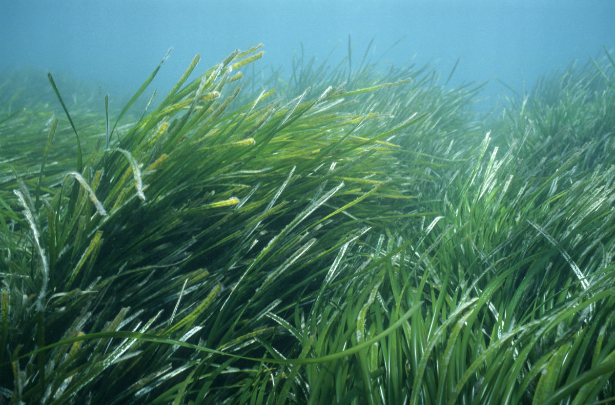
© Michel Gunther/WWF-Canon
In order to formulate the appropriate and necessary conservation measures, it is imperative that the state of local fish stocks should be assessed and the important marine habitats should be mapped in the wider marine area of Gyaros. The project’s team in collaboration with a team of expert marine scientists in order to collect the necessary scientific data, will conduct a series of surveys in the marine part of the project area. The selection of the survey areas will be based on the valuable information that will be gathered through interviews with professional fishermen from Andros and Syros, in order to identify important fishing grounds and areas of particular interest.
The study of the marine environment, will involve mapping of the Posidonia oceanica beds, and of the tragana marine habitats, as well as the assessment of the local fish stocks in the wider marine area of the Gyaros Natura 2000 area. Thus, two parallel field studies will be conducted.
The first one concerns the mapping of marine habitats and will be implemented with the use of the latest technology and geophysical mapping instruments, focusing on Posidonia beds and on areas with Tragana presence (Coralligenous beds).
The second one is an experimental fisheries research survey that based on seasonal samplings, that will assess the status of the local fish stocks, especially for those species that are prey for the Mediterranean Monk seal, Monachus monachus.
For the purposes of these research actions the “CYCLADES LIFE” team, assisted by the team of expert marine scientist, will conduct a series of field surveys by boat, in close collaboration with local fishermen, using specialized equipment (side scan sonar, doppler sonar profilers etc.) as well as visual observations with unmanned underwater vessels and scientific diving. The collected data will be recorded in GIS, and they will include the distribution and characteristics of the targeted marine habitats, as well as the status of fish stocks of wider marine area of Gyaros.
Based on the data collected from these studies, the project team will create a database documenting all the relevant information related to the marine natural environment of the wider Gyaros area. This will be of seminal value during the formulation of the two required studies (Special Environmental Study (SES) and Ecological Study (ES)), that will provide the necessary scientific arguments and will validate the legal establishment of the new Marine Protected Area, securing at the same time the implementation of the appropriate protection measures through the formulation and adoption of an Ecosystem Based Management plan.